SHEET C-101 // CONSTRUCTION DRONE SERVICES
REV 2026.07 · SCALE 1:500 · UAS-RTK
CONSTRUCTION INTELLIGENCE
Construction drone mapping and reality capture for active jobsites — orthomosaic mapping, earthwork verification, and construction progress documentation your whole team can measure against, from groundbreak to closeout.
FIG. 01 — WEEKLY SITE CAPTURE
GSD 1.5 CM/PX
N 34°03′08″ · W 118°14′34″
DATUM NAVD88 · RTK FIX · FAA PART 107
BUILD TIMELINE
One capture program that follows your project through every phase — keep scrolling and the timeline advances with you, or hover any phase to explore.
Baseline orthomosaic before ground breaks. Cut/fill tracked against design grade every flight — overruns show up in days, not invoices.
HOW IT WORKS ON SITE
ORTHOMOSAIC MAPPING
An orthomosaic is a single top-down image of the entire site, stitched from hundreds of overlapping aerial photos and corrected so that scale stays consistent edge to edge. Unlike a photograph taken from a corner of the site, distances measured on an orthomosaic are true distances on the ground.
CONSTRUCTION SITE DOCUMENTATION
Site documentation fails when it depends on who happened to take a photo that week. A scheduled capture removes that dependency: the whole site is recorded on a fixed cadence, in the same flight plan, at the same resolution, whether or not anyone thought to document a specific area.
REALITY CAPTURE WORKFLOW
Every engagement follows the same four steps: plan the flight around live site conditions, capture with RTK positioning and ground control where accuracy demands it, process imagery into orthomosaics and surface models, then quality-check the output against control before anything reaches your team.
PROGRESS TRACKING
Progress tracking works best when it is tied to something you already manage. Captures are aligned to schedule milestones and pay periods, so the question in a progress meeting shifts from whether an area is complete to how much of it is complete and when it changed.
PROGRESS COMPARISON
Drag the divider. Every flight becomes a documented state of the site you can compare, measure, and hold the schedule against.


SAME FLIGHT PLAN · SAME ANGLES · TRUE COMPARISON
CAPTURE INTERVAL: WEEKLY
QUANTITIES YOU CAN DEFEND
EARTHWORK MONITORING
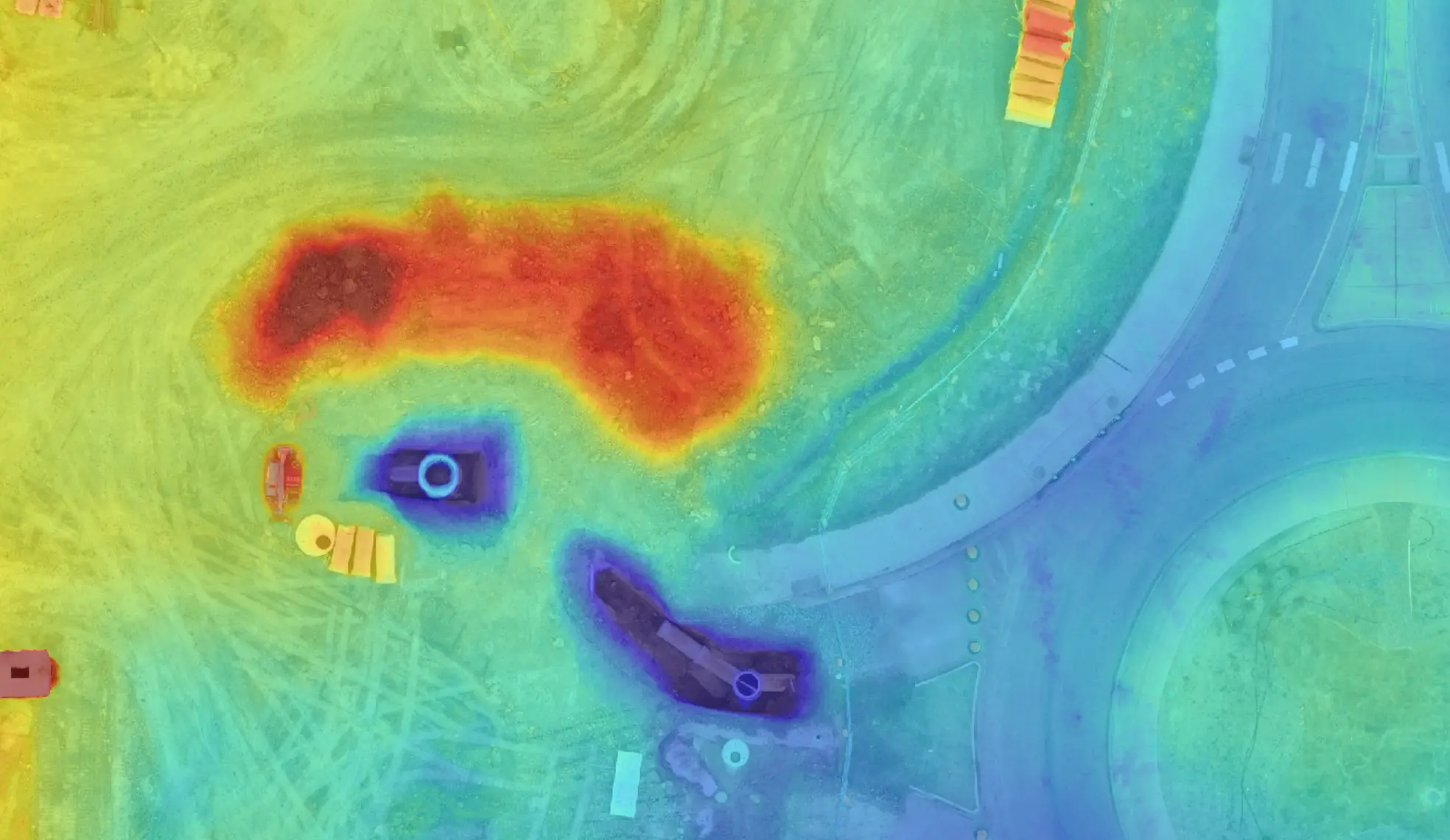
Earthwork is where budgets move fastest and where documentation is usually thinnest. Each capture produces a surface model of the site as it stands, which is compared against the design surface or the previous week to calculate cut and fill volumes.
Over-excavation, unbalanced sites, and grade that drifts out of tolerance surface within days rather than at the end of the phase — while there is still schedule and budget available to correct them.
STOCKPILE MEASUREMENT
Stockpile volumes are computed from the captured surface against a defined base, not estimated from truck counts or pacing. A pile that takes an afternoon to survey conventionally is measured from a flight that was happening anyway.
For owners running several sites, the same method applied everywhere makes material positions comparable across a portfolio — the numbers were produced the same way, so they can be read side by side.
FIELD-PROVEN
Captured, processed, and delivered across construction projects in the United States.
Acres Documented
Aerial coverage across active construction and infrastructure sites.
Construction Flights
Recurring capture missions flown on live jobsites without disruption.
On-Time Delivery
Datasets delivered on schedule, quality-checked before they reach your team.
DELIVERABLES
.01
PROGRESS ORTHOMOSAICS
A current, measurable top-down map of the whole site after every flight — the single picture everyone plans against.
.02
CUT/FILL & STOCKPILES
Independent earthwork quantities measured from the surface itself — verify hauling tickets and pay apps with data.
.03
3D SITE MODELS
Textured reality models of the site as it stands — for coordination, logistics planning, and stakeholder reviews.
.04
FACADE & ROOF SETS
Inspection-grade image sets of vertical work and roof zones — documented without lifts, ladders, or shutdowns.
.05
SCHEDULE COMPARISONS
Week-over-week visual diffs of the site tied to your milestones — see slippage while there is still time to act.
.06
AS-BUILT ARCHIVE
A permanent, organized record of every capture from groundbreak to handover — evidence that outlives the project.
SELECTED WORK
Capture programs across warehouse, infrastructure, and commercial construction — the scope, the flight cadence, and what each project team received.
THE PLATFORM
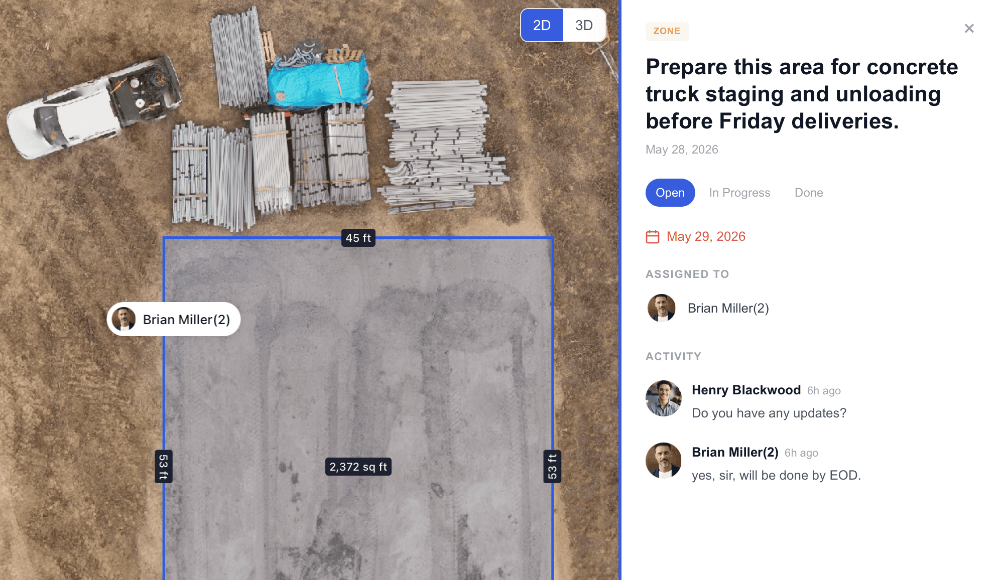
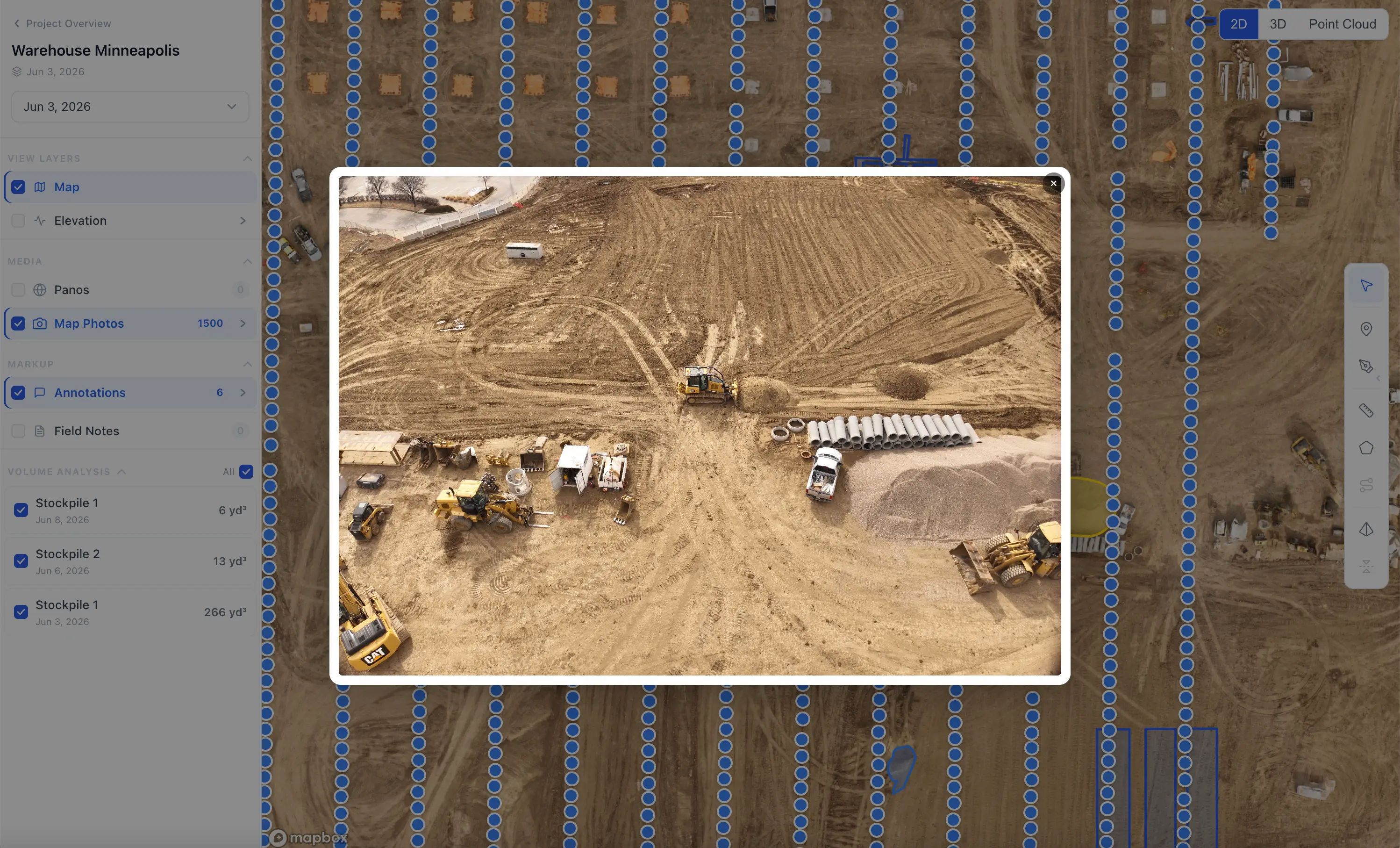
Captured data is only useful if your team can work with it. Every deliverable lands in the Asteon platform, where distances, areas, and volumes are measured directly on the current capture — no desktop GIS, no specialist licence.


FAQ
QUESTIONS FROM THE FIELD
NEXT FLIGHT WINDOW: THIS WEEK
PUT YOUR SITE ON RECORD
Tell us about your project and we will scope a capture program that fits your schedule, phases, and reporting needs.